Google has several ways in which it is possible to track the effects of climate change. The intention behind these tools is allow any person to see for themselves what is happening around the world as a result of climate change.
Street View images[edit | edit source]
Street View can be used to find ecosystems changing as a result of climate change.[1] As well as showing the changes, the tool also links you to the conservation organizations that are doing something about the changes.
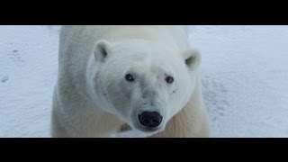
Polar Bear International is mapping polar bears and their fragile sea ice habitat near Churchill, Manitoba using Street View Trekker.[1]They also have a Tundra Outreach Program that helps school students to explore the area and learn more.
The Nature Conservancy - California uses the Street View Trekker to analyse what is happening to the blue oak trees in Central California. These trees are in decline due to changing temperatures. The images are being used to monitor the changes and record them, to try to find ways to conserve the trees, which are at risk of losing up to 41 percent of the tree population by 2100.[1]
- The Nature Conservancy Preserves: https://www.google.com/maps/streetview/#the-nature-conservancy-preserves
- Exploring the Preserves: https://www.google.com/maps/@37.4125125,-121.7333775,3a,75y,356.14h,96.99t/data=!3m6!1e1!3m4!1srGSO4sQ_qchVlt73szmQcQ!2e0!7i13312!8i6656
The Brazilian Amazon is being monitored by the Amazonas Sustainable Foundation using the Street View Tracker and provides people with a chance to see what the forest is like on the ground and to encourage people around the world to understand the importance of rainforest protection and sustainable ecosystem management.[1]The images are being used to map the local forest communities impacted by climate change.
- Walking through the rainforests: https://www.google.com/maps/@-5.7475207,-60.4515752,3a,75y,10.62h,106.63t/data=!3m5!1e1!3m3!1sfJctI0gI5xeXixEbARSZzw!7i13312!8i6656
- Viewing the Amazon River tributaries: https://www.google.com/maps/@-3.1377605,-60.4933549,3a,75y,154.19h,92.8t/data=!3m5!1e1!3m3!1s1ci-8iBT_UuG1dlrUy1vzg!7i13312!8i6656
Google Earth layers[edit | edit source]
Google Earth has a series of layers and tours that allow you to check out the potential impacts of climate change, along with proposed solutions.[2] This initiative was created with the Danish government prior to the 2009 COP 15 in Copenhagen.[2]The data used is sourced from the Intergovernmental Panel on Climate Change (IPCC), which enables you to view the range of potential temperature and precipitation changes that will occur under different global emissions scenarios.[2]
Google Earth and climate change tours[edit | edit source]
- COP 15 tour: http://www.google.com/landing/cop15/
- COP 16 tour: https://www.google.com/landing/cop16/climatetours.html
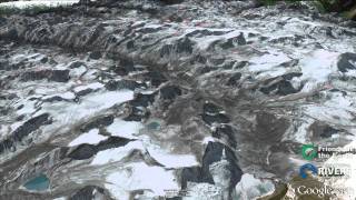
- COP 17 tour: Wrong Climate for Damming Rivers:[3]
Sea level rise[edit | edit source]
There are various sites that use Google Maps to show sea level rise impacts.
- http://worldunderwater.org/#/
- David Sadoff explains how to make a sea level rise simulation using Google Earth:
