
- Fort Wayne churches choosing solar power, Jun 18, 2016...[1]
Networks and sustainability initiatives[edit | edit source]
Food activism[edit | edit source]
Community energy[edit | edit source]
Wind power in Indiana was limited to a few small water-pumping windmills on farms until 2008 with construction of Indiana's first utility-scale wind power facility, Goodland (phase I) with a nameplate capacity of 130 MW. As of March of 2024, Indiana had a total of 2,743 MW of wind power capacity installed, ranking it 12th among U.S. states. Wind power was responsible for 4.8% of in-state electricity production in 2016.
Solar power in Indiana has been growing in recent years due to new technological improvements and a variety of regulatory actions and financial incentives, particularly a 30% federal tax credit for any size project.
In 2015, Indiana ranked 18th among U.S. states for installed solar power with 136 MW of photovoltaic panels. An estimated 18% of electricity in Indiana could be provided by rooftop solar panels.
The Mammoth Solar project in Northwest Indiana broke ground in October 2021, and when complete it will be the largest solar project in the United States, with more than 2.8 million panels producing more than 1 gigawatt of power.
Climate action[edit | edit source]
Climate change in Indiana encompasses the effects of climate change, attributed to man-made increases in atmospheric carbon dioxide, in the U.S. state of Indiana.
According to the United States Environmental Protection Agency, "Indiana's climate is changing. Most of the state has warmed about one degree (F) in the 20th century. Floods are becoming more frequent, and ice cover on the Great Lakes is forming later or melting sooner. In the coming decades, the state will have more extremely hot days, which may harm public health in urban areas and corn harvests in rural areas". In May 2019, The Kansas City Star noted that although it was not yet possible to say whether climate change was contributing to the increasing number of tornadoes in the region, "the band of states in the central United States ... that each spring are ravaged by hundreds of tornadoes — is not disappearing. But it seems to be expanding", resulting in a higher frequency of tornadoes in states including Indiana.
Indiana is one of the ten states that produce half of all greenhouse gas emissions in the US.
"Changing the climate is likely to increase the frequency of floods in Indiana. Over the last half century, average annual precipitation in most of the Midwest has increased by 5 to 10 percent. But rainfall during the four wettest days of the year has increased about 35 percent, and the amount of water flowing in most streams during the worst flood of the year has increased by more than 20 percent. During the next century, spring rainfall and average precipitation are likely to increase, and severe rainstorms are likely to intensify. Each of these factors will tend to further increase the risk of flooding".
"Flooding occasionally threatens both navigation and riverfront communities, and greater river flows could increase these threats. In 2011, a combination of heavy rainfall and melting snow caused flooding along the Ohio and Wabash rivers in Southern Indiana and closed the lower Ohio River to navigation. Although springtime in Indiana is likely to be wetter, summer droughts are likely to be more severe. Higher evaporation and lower summer rainfall are likely to reduce river flows. The drought of 2005 caused portions of the lower Ohio River to be closed to commercial navigation, which delayed shipments of crops and other products to and from upstream states like Indiana. In 2012, a drought caused navigation restrictions on the lower Mississippi River, which cost the region more than $275 million".
"The ice-free season along the Great Lakes is also becoming longer. Between 1994 and 2011, reduced ice cover lengthened the shipping season on the lakes by eight days. The Great Lakes are likely to warm another 3° to 7°F in the next 70 years, which will further extend the shipping season. In Lake Michigan, the changing climate is likely to harm water quality. Warmer water tends to cause more algal blooms, which can be unsightly, harm fish, and degrade water quality. Severe storms also increase the amount of pollutants that run off from land to water, so the risk of algal blooms will be greater if storms become more severe. Increasingly severe rainstorms could also cause sewers to overflow into the lake more often, threatening beach safety and drinking water supplies".
"Changing the climate will have both beneficial and harmful effects on farming. Longer frost-free growing seasons and higher concentrations of atmospheric carbon dioxide would increase yields for some crops during an average year. But increasingly hot summers are likely to reduce yields of corn and possibly soybeans. Seventy years from now, much of Indiana is likely to have 5 to 15 more days per year with temperatures above 95°F than it has today. More severe droughts or floods would also hurt crop yields".
"Rising temperatures can harm air quality and amplify existing threats to human health. Warmer weather can increase the production of ground-level ozone, a pollutant that causes lung and heart problems. Ozone also harms plants. In rural Indiana, ozone levels are high enough to significantly reduce yields of soybeans and winter wheat. EPA and the Indiana Department of Environmental Management have been working to reduce ozone concentrations".
"Midwestern cities like Indianapolis are vulnerable to heat waves, because many houses and apartments lack air conditioning, and urban areas are typically warmer than their rural surroundings. In recent decades, severe heat waves have killed hundreds of people across the Midwest. Heat stress is expected to increase as climate change brings hotter summer temperatures and more humidity. Certain people are especially vulnerable, including children, the elderly, the sick, and the poor".
Earth Charter Indiana has worked to develop leadership in sustainability and climate action for almost 20 years. Its Youth Power Indiana initiative works with students in elementary through high school, and with mayors and municipal officials to develop sustainability and resiliency programs. Young people have advocated climate policy which has been adopted in seven cities: Carmel, Indianapolis, Lawrence, South Bend, Goshen, Bloomington and West Lafayette.
Indiana Project Drawdown has assembled information on hundreds of local groups in the state which are making progress on emissions reduction.
Publicly available data is available to communities and government via the Hoosier Resilience Index, an online database listing information such as "precipitation, flood plain and land use maps – for every community in the state of Indiana."
Carbon Neutral Indiana (CNI) is a non-profit organization that works with households, businesses, and academic institutions to measure, offset, and reduce their carbon footprint. Their goal is to spark a movement amongst Hoosiers to ensure Indiana becomes carbon neutral as soon as possible.
- List of U.S. states and territories by carbon dioxide emissions
- Plug-in electric vehicles in Indiana
- Angel, J.; C. Swanston; B.M. Boustead; K.C. Conlon; K.R. Hall; J.L. Jorns; K.E. Kunkel; M.C. Lemos; B. Lofgren; T.A. Ontl; J. Posey; K. Stone; G. Tackle; D. Todey (2018). "Midwest". In Reidmiller, D.R.; C.W. Avery; D.R. Easterling; K.E. Kunkel; K.L.M. Lewis; T.K. Maycock; B.C. Stewart (eds.). Impacts, Risks, and Adaptation in the United States: Fourth National Climate Assessment, Volume II (Report). Washington, DC, USA: U.S. Global Change Research Program. pp. 872–940. doi:10.7930/NCA4.2018.CH21.—this chapter of the National Climate Assessment covers Midwest states (Illinois, Indiana, Iowa, Michigan, Minnesota, Missouri, Ohio, and Wisconsin).
Climate change in Indiana[edit | edit source]
Climate change in Indiana encompasses the effects of climate change, attributed to man-made increases in atmospheric carbon dioxide, in the U.S. state of Indiana.
According to the United States Environmental Protection Agency, "Indiana's climate is changing. Most of the state has warmed about one degree (F) in the 20th century. Floods are becoming more frequent, and ice cover on the Great Lakes is forming later or melting sooner. In the coming decades, the state will have more extremely hot days, which may harm public health in urban areas and corn harvests in rural areas". In May 2019, The Kansas City Star noted that although it was not yet possible to say whether climate change was contributing to the increasing number of tornadoes in the region, "the band of states in the central United States ... that each spring are ravaged by hundreds of tornadoes — is not disappearing. But it seems to be expanding", resulting in a higher frequency of tornadoes in states including Indiana.
Indiana is one of the ten states that produce half of all greenhouse gas emissions in the US.
"Changing the climate is likely to increase the frequency of floods in Indiana. Over the last half century, average annual precipitation in most of the Midwest has increased by 5 to 10 percent. But rainfall during the four wettest days of the year has increased about 35 percent, and the amount of water flowing in most streams during the worst flood of the year has increased by more than 20 percent. During the next century, spring rainfall and average precipitation are likely to increase, and severe rainstorms are likely to intensify. Each of these factors will tend to further increase the risk of flooding".
"Flooding occasionally threatens both navigation and riverfront communities, and greater river flows could increase these threats. In 2011, a combination of heavy rainfall and melting snow caused flooding along the Ohio and Wabash rivers in Southern Indiana and closed the lower Ohio River to navigation. Although springtime in Indiana is likely to be wetter, summer droughts are likely to be more severe. Higher evaporation and lower summer rainfall are likely to reduce river flows. The drought of 2005 caused portions of the lower Ohio River to be closed to commercial navigation, which delayed shipments of crops and other products to and from upstream states like Indiana. In 2012, a drought caused navigation restrictions on the lower Mississippi River, which cost the region more than $275 million".
"The ice-free season along the Great Lakes is also becoming longer. Between 1994 and 2011, reduced ice cover lengthened the shipping season on the lakes by eight days. The Great Lakes are likely to warm another 3° to 7°F in the next 70 years, which will further extend the shipping season. In Lake Michigan, the changing climate is likely to harm water quality. Warmer water tends to cause more algal blooms, which can be unsightly, harm fish, and degrade water quality. Severe storms also increase the amount of pollutants that run off from land to water, so the risk of algal blooms will be greater if storms become more severe. Increasingly severe rainstorms could also cause sewers to overflow into the lake more often, threatening beach safety and drinking water supplies".
"Changing the climate will have both beneficial and harmful effects on farming. Longer frost-free growing seasons and higher concentrations of atmospheric carbon dioxide would increase yields for some crops during an average year. But increasingly hot summers are likely to reduce yields of corn and possibly soybeans. Seventy years from now, much of Indiana is likely to have 5 to 15 more days per year with temperatures above 95°F than it has today. More severe droughts or floods would also hurt crop yields".
"Rising temperatures can harm air quality and amplify existing threats to human health. Warmer weather can increase the production of ground-level ozone, a pollutant that causes lung and heart problems. Ozone also harms plants. In rural Indiana, ozone levels are high enough to significantly reduce yields of soybeans and winter wheat. EPA and the Indiana Department of Environmental Management have been working to reduce ozone concentrations".
"Midwestern cities like Indianapolis are vulnerable to heat waves, because many houses and apartments lack air conditioning, and urban areas are typically warmer than their rural surroundings. In recent decades, severe heat waves have killed hundreds of people across the Midwest. Heat stress is expected to increase as climate change brings hotter summer temperatures and more humidity. Certain people are especially vulnerable, including children, the elderly, the sick, and the poor".
Earth Charter Indiana has worked to develop leadership in sustainability and climate action for almost 20 years. Its Youth Power Indiana initiative works with students in elementary through high school, and with mayors and municipal officials to develop sustainability and resiliency programs. Young people have advocated climate policy which has been adopted in seven cities: Carmel, Indianapolis, Lawrence, South Bend, Goshen, Bloomington and West Lafayette.
Indiana Project Drawdown has assembled information on hundreds of local groups in the state which are making progress on emissions reduction.
Publicly available data is available to communities and government via the Hoosier Resilience Index, an online database listing information such as "precipitation, flood plain and land use maps – for every community in the state of Indiana."
Carbon Neutral Indiana (CNI) is a non-profit organization that works with households, businesses, and academic institutions to measure, offset, and reduce their carbon footprint. Their goal is to spark a movement amongst Hoosiers to ensure Indiana becomes carbon neutral as soon as possible.
- List of U.S. states and territories by carbon dioxide emissions
- Plug-in electric vehicles in Indiana
- Angel, J.; C. Swanston; B.M. Boustead; K.C. Conlon; K.R. Hall; J.L. Jorns; K.E. Kunkel; M.C. Lemos; B. Lofgren; T.A. Ontl; J. Posey; K. Stone; G. Tackle; D. Todey (2018). "Midwest". In Reidmiller, D.R.; C.W. Avery; D.R. Easterling; K.E. Kunkel; K.L.M. Lewis; T.K. Maycock; B.C. Stewart (eds.). Impacts, Risks, and Adaptation in the United States: Fourth National Climate Assessment, Volume II (Report). Washington, DC, USA: U.S. Global Change Research Program. pp. 872–940. doi:10.7930/NCA4.2018.CH21.—this chapter of the National Climate Assessment covers Midwest states (Illinois, Indiana, Iowa, Michigan, Minnesota, Missouri, Ohio, and Wisconsin).
Sustainable transport activism[edit | edit source]
Wikipedia: Hiking trails in Indiana (category)
Cycling activism[edit | edit source]
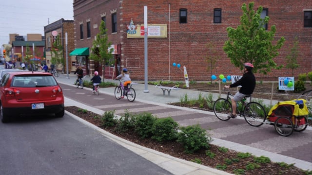

Wikipedia: Bike paths in Indiana (category)
Education for sustainability[edit | edit source]
Merry Lea Environmental Learning Center of Goshen College is located just south of Wolf Lake at Bear Lake in Noble County, Indiana, United States. Merry Lea is the largest privately held land reserve in the state of Indiana. The center serves as a field laboratory for students at Goshen College who are studying ecology, environmental education and agroecology. In addition, Merry Lea provides environmental educational experiences for elementary students in the center's service area which includes the Fort Wayne metropolitan area as well as Warsaw, Huntington, Kendallville, Goshen and Elkhart.
The facility's 1,150 acres (4.6 km2) include most of northern Indiana's ecosystems including peat bogs, swamp maple forest, upland mesic forest, old field, prairie, and lakeshore. An esker deposit with 50 ft (15 m) relief that extends for nearly half a mile (1 km) is the most striking geological feature. The center also features Rieth Village, a complex of energy efficient buildings completed in 2006 that provide housing and classrooms for college students. Rieth Village features a 10 kW wind generator mounted on a 100 ft (30 m) tower and 4.8 kW photovoltaic array.
- Merry Lea Environmental Learning Center of Goshen College, added 15:51, 3 January 2022 (UTC)
Ecological restoration[edit | edit source]
The Lilly ARBOR Project is a part of an experimental riparian floodplain reforestation and ecological restoration program, located along the White River in Indianapolis, Indiana, United States. ARBOR is an acronym for "Answers for Restoring the Bank Of the River".
Open spaces[edit | edit source]
Sycamore Land Trust is a 501(c)(3) non-profit member-supported land trust headquartered in Bloomington in the U.S. state of Indiana.
It works to preserve the disappearing natural and agricultural landscape of southern Indiana. Sycamore's service area includes 26 southern Indiana counties: Bartholomew, Brown, Clark, Crawford, Dubois, Daviess, Floyd, Gibson, Greene, Harrison, Jackson, Knox, Lawrence, Martin, Monroe, Morgan, Orange, Owen, Perry, Pike, Posey, Scott, Spencer, Vanderburgh, Warrick, and Washington.
The trust is part of the US Land Trust Alliance. In 2023, the trust has 7 full-time staff and over 100 volunteers.
Since its founding in 1990, Sycamore has protected more than 9,000 acres of land on 100 parcels. Many of the properties that Sycamore owns outright have hiking trails and are open to the general public.
Sycamore Land Trust is a 501(c)(3) non-profit member-supported land trust headquartered in Bloomington in the U.S. state of Indiana.
It works to preserve the disappearing natural and agricultural landscape of southern Indiana. Sycamore's service area includes 26 southern Indiana counties: Bartholomew, Brown, Clark, Crawford, Dubois, Daviess, Floyd, Gibson, Greene, Harrison, Jackson, Knox, Lawrence, Martin, Monroe, Morgan, Orange, Owen, Perry, Pike, Posey, Scott, Spencer, Vanderburgh, Warrick, and Washington.
The trust is part of the US Land Trust Alliance. In 2023, the trust has 7 full-time staff and over 100 volunteers.
Since its founding in 1990, Sycamore has protected more than 9,000 acres of land on 100 parcels. Sycamore protects land by owning nature preserves, and by holding permanent conservation easements on privately owned land. Properties span fifteen Indiana counties, including Bartholomew, Brown, Crawford, Gibson, Greene, Harrison, Knox, Lawrence, Martin, Monroe, Morgan, Orange, Owen, Pike, and Vanderburgh Counties. Many of the properties that Sycamore owns outright have hiking trails and are open to the general public.
In September 2012, in its largest land protection project to date, Sycamore Land Trust acquired 1,043-acre tract adjoining the Patoka River National Wildlife Refuge and Management Area, one of three national wildlife refuges in Indiana. The property features forested wetlands, upland forests, and planted prairies which provide habitat for several threatened species such as the Indiana bat, bobcat, river otter, and copperbelly watersnake.
In August 2012, Sycamore partnered with Capriole Farm in Greenville, Indiana, to permanently protect the historic farmstead that gave rise to the internationally recognized Capriole Goat Cheese. Capriole is now the last working dairy farm in Floyd County. Earlier that summer, Sycamore acquired its first property in Vanderburgh County, Eagle Slough Natural Area. Due to its landscape of wetlands and bottomland forest, Eagle Slough provides an excellent habitat for more than 150 different species of birds. The property is also home to some of the largest bald cypress trees in the state of Indiana.
Place markers on the Sycamore preserve map indicate preserves that are accessible to the general public for hiking and exploring. Other preserves may not be accessible to the public because of limited road access and parking.
The most accessible Sycamore properties include Beanblossom Bottoms Nature Preserve and the Amy Weingartner Branigin Peninsula Preserve in Monroe County, the Cedars Preserve in southern Monroe County, Columbia Mine Preserve in Gibson and Pike Counties, Eagle Slough Natural Area in Evansville, IN, the Jeremy K. Oakley Preserve in northeastern Lawrence County, the Laura Hare Nature Preserve at Downey Hill, Bob Klawitter Lake Lemon Woods in northeastern Monroe County, Porter West Preserve in western Monroe County, Powell Preserve in northwest Monroe County, Scarlet Oak Woods in central Monroe County, Tangeman Woods in western Bartholomew County, Touch the Earth in central Bartholomew County, and Canyon Forest Nature Preserve in northeastern Greene County.
Sycamore has an active and award-winning Environmental Education Program that helps people in southern Indiana build an understanding of Indiana's natural heritage and the Earth's delicately balanced living systems. Sycamore believes that nature is the ultimate educator and offers lessons that reinforce school curriculum as well as program for families and the community.
The Environmental Education program focuses on three approaches: individual teachers and classes; larger scale projects; and cooperative projects. Through classroom work, Sycamore leads outdoor discovery activities, hiking, exploring, math or science lessons, and reflective writing. Larger projects include a watershed study project on Beanblossom Creek and cooperative field days that create a dynamic learning environment. In 2023, the Environmental Education plans to work with 6,000 people.
In 2007 Sycamore received a National Arbor Day Award in the Project category for planting over 50,000 trees throughout southern Indiana. Also in 2007 Sycamore received an Indiana Achievement Award in the Impact category for excellence in land protection and restoration, and environmental education. In 2009 Sycamore's Environmental Education Program was again honored, receiving the Governor's Award in the Outreach or Education category. In 2010, Indiana Governor Mitch Daniels proclaimed the week of February 22–28 Sycamore Land Trust Week.
- "Benefits of the trust: Bicentennial Nature Trust’s $30 million helps agencies acquire thousands of acres across Indiana" - The Herald-Times
- "With Invasives, Ounce of Protection is Worth a Pound of Cure" - Earth Eats, Indiana Public Media
- Sycamore Land Trust opens new preserve on Lake Monroe
- Environmental education program will come to school districts around Indiana this fall – Indiana Daily Student
- "Frogs, Rails, and Eagles Oh My!" - Adventure Indiana
- Vicky J. Meretsky
- Official website
- Sycamore Preserves and Where to Visit
- Sycamore on Facebook
- Sycamore on Twitter
Citizens data initiative[edit | edit source]
Energy Data & Statistics for Indiana, from the U.S. Department of Energy
News and comment[edit | edit source]
2016
Hard-Pressed Rust Belt Cities Go Green to Aid Urban Revival, May 31[2]
Greenfield: Nonprofit farm seeks to feed those in need, March 10[3]
2015
Fort Wayne: Growing home harvests, August 16[4]
About Indiana[edit | edit source]
Indiana ( IN-dee-AN-ə) is a state in the Midwestern region of the United States. It borders Lake Michigan to the northwest, Michigan to the north and northeast, Ohio to the east, the Ohio River and Kentucky to the south and southeast, and the Wabash River and Illinois to the west. Nicknamed "the Hoosier State", Indiana is the 38th-largest by area and the 17th-most populous of the 50 states. Its capital and largest city is Indianapolis. Indiana was admitted to the United States as the 19th state on December 11, 1816.
References