
Size of this preview: 776 × 600 pixels. Other resolutions: 2,560 × 1,978 pixels | 3,300 × 2,550 pixels.
Original file (3,300 × 2,550 pixels, file size: 1.23 MB, MIME type: image/jpeg)
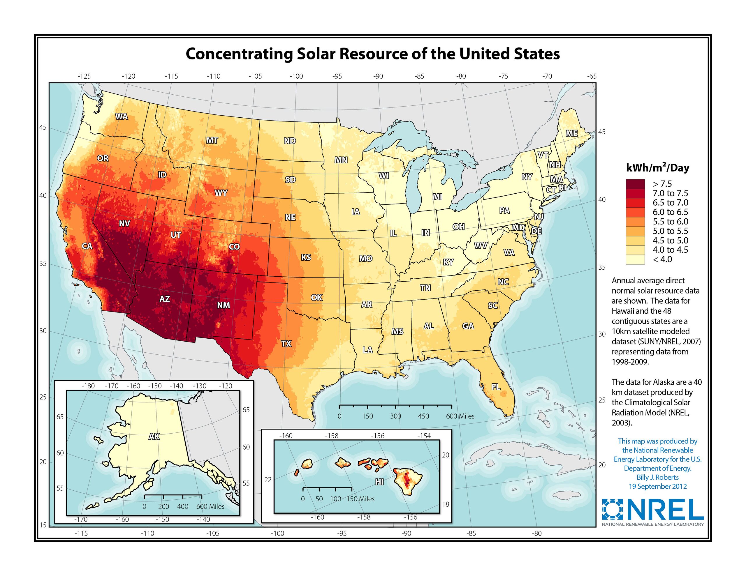
From NREL, a map showing the CSP potential in the United States. Originally from: http://www.nrel.gov/gis/solar.html
File history
Click on a date/time to view the file as it appeared at that time.
| Date/Time | Thumbnail | Dimensions | User | Comment | |
|---|---|---|---|---|---|
| current | 23:59, 30 November 2013 | | 3,300 × 2,550 (1.23 MB) | Dkucera (talk | contribs) | From NREL, a map showing the CSP potential in the United States. Originally from: http://www.nrel.gov/gis/solar.html |
You cannot overwrite this file.
File usage
The following 2 pages use this file: